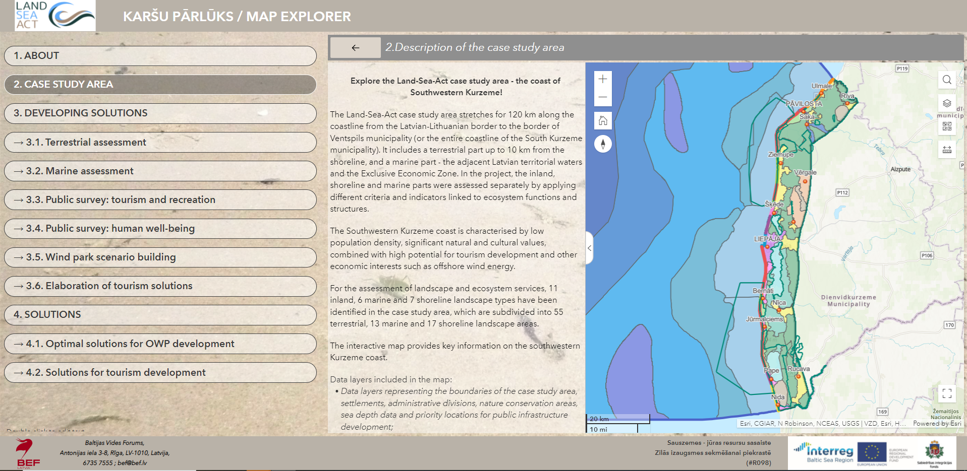
The final version of the Land-Sea-Act Map Explorer is now available to users. The Map Explorer provides an overview of the conducted landscape and ecosystem service assessment of the Southwestern Kurzeme coast case study, as well as the proposed solutions for offshore wind parks and tourism development and methods used in the case study.
Interreg project “Land-sea interactions advancing Blue Growth in Baltic Sea coastal areas“(acronym Land-Sea-Act) explores the interactions between sea and land, and aims to bring together stakeholders and citizens involved in coastal management to address the challenges of maritime planning and coastal development. In Latvia, the selected case study area is the Southwestern Kurzeme coast. Southwestern Kurzeme case study seeks solutions for balancing national interests in offshore wind energy development and local interests in preserving the coastal landscape and promoting tourism development.
The Map Explorer is interactive. It provides textual information about the case study area, developed solutions and methodology used in the study, as well as interactive maps. The maps contain: 1) relevant spatial data about the case study area, 2) spatial representations of the project’s assessments of the ecosystem services and landscapes of the Southwestern Kurzeme coast, 3) the optimal solutions for offshore wind park and sustainable landscape-based tourism development elaborated in the Land-Sea-Act project.
The Land-Sea-Act Map Explorer has been demonstrated at several conferences, stakeholder workshops and other events, where it has been recognised as an effective tool for engaging stakeholders and communicating project results to practitioners and the wider public. The Map Explorer is available in Latvian and English.
The information available in the Land-Sea-Act Map Explorer could be particularly useful for planners, decision-makers and other professionals who:
1) work on land and sea development issues in the Southwestern Kurzeme region (in particular tourism, offshore wind park development) and want to have a deeper understanding of the specifics of the territory and how to create a balanced development of the coastal area;
2) are interested in gaining more knowledge and understanding of the different methods that can be used in the planning of balanced sea-land interactions and development in general.
Access the Land-Sea-Act Map Explorer here: https://experience.arcgis.com/experience/2447e76e306a4e68bf82323e33b72b26/page/ENG/